
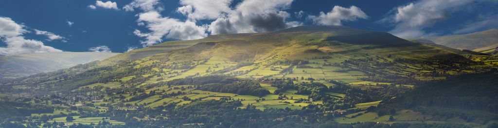
Mountain weather
Bannau Brycheiniog / Brecon Beacons Mountain weather forecast table
Confidence
High for settled conditions initially. Low for details toward the weekend with the risk of thunderstorms from Friday onwards.
This evening forecast
Fine and dry with high level cloud moving in.
Mountain weather hazards
Hazards apply at or above 300m, reflecting the more severe conditions which can occur at altitude.
 Strong Sunlight
Harmful UV levels from sunlight increase with altitude giving a greater risk of sunburn and eye damage, even on some overcast days. On breezy days, the cooling effect of wind on exposed skin may disguise any feeling of sunburn until it is too late. If there is snow cover, glare increases the effect of UV rays especially on the eyes. It is advisable to wear sun block, protective clothing such as a long-sleeved top and hat and have good quality eye protection.
Gales
Gale force winds (gusts over 50mph) make walking difficult and strenuous with a potential to be blown over by gusts. There is often a marked increase in winds through cols or on exposed ridges and summits. Distances can take longer to cover and compass bearings become harder to follow accurately.
Severe Chill Effect
Wind significantly lowers the ‘feels-like’ temperature relative to the actual temperature, with even moderate winds significantly adding to the chilling effect. Strong winds can result in a severe and debilitating wind chill many degrees below the actual temperature. This effect will be enhanced in rain or wet snow. Without protection, prolonged exposure could result in frost nip or frostbite on exposed parts of the body and/or hypothermia.
Mountain weather forecast
Dry with plenty of sunshine and brisk winds.
| Time | 00:00 | 03:00 | 06:00 | 09:00 | 12:00 | 15:00 | 18:00 | 21:00 |
|---|---|---|---|---|---|---|---|---|
Weather (at 600m) |
|
|
|
|
|
|
|
|
Chance of precipitation (at 600m) |
<05% | <05% | <05% | <05% | <05% | <05% | <05% | <05% |
Wind direction and speed (mph)
Altitude above mean sea level
| Time | 00:00 | 03:00 | 06:00 | 09:00 | 12:00 | 15:00 | 18:00 | 21:00 |
|---|---|---|---|---|---|---|---|---|
| 600m |
E
25
|
E
27
|
E
24
|
E
21
|
SE
23
|
SE
21
|
SE
18
|
SE
17
|
| 300m |
E
11
|
E
9
|
E
9
|
E
13
|
E
14
|
E
12
|
E
8
|
E
6
|
| Valley |
E
9
|
E
7
|
E
7
|
E
12
|
E
13
|
E
12
|
SE
7
|
E
6
|
Wind gust (mph)
Altitude above mean sea level
| Time | 00:00 | 03:00 | 06:00 | 09:00 | 12:00 | 15:00 | 18:00 | 21:00 |
|---|---|---|---|---|---|---|---|---|
| 600m | 39 | 42 | 37 | 32 | 31 | 30 | 26 | 28 |
| 300m | 27 | 24 | 23 | 23 | 25 | 23 | 18 | 17 |
| Valley | 27 | 23 | 23 | 24 | 27 | 24 | 20 | 18 |
Altitude above mean sea level
| Time | 00:00 | 03:00 | 06:00 | 09:00 | 12:00 | 15:00 | 18:00 | 21:00 |
|---|---|---|---|---|---|---|---|---|
| 600m |
7°
|
8°
|
8°
|
11°
|
14°
|
16°
|
15°
|
12°
|
| 300m |
7°
|
6°
|
6°
|
12°
|
18°
|
19°
|
16°
|
12°
|
| Valley |
8°
|
6°
|
7°
|
13°
|
18°
|
20°
|
17°
|
12°
|
| Freezing Level |
1,800m
|
1,700m
|
2,000m
|
1,900m
|
1,900m
|
1,800m
|
1,900m
|
2,600m
|
Altitude above mean sea level
| Time | 00:00 | 03:00 | 06:00 | 09:00 | 12:00 | 15:00 | 18:00 | 21:00 |
|---|---|---|---|---|---|---|---|---|
| 600m |
2°
|
3°
|
4°
|
7°
|
10°
|
11°
|
11°
|
9°
|
| 300m |
4°
|
3°
|
4°
|
10°
|
14°
|
16°
|
15°
|
10°
|
| Valley |
6°
|
4°
|
6°
|
11°
|
15°
|
16°
|
15°
|
11°
|
Additional weather information
Meteorologist's view
Given the time of year, sunshine will become quite strong, so sun protection is advised. There will be a chilly wind on the hill tops first thing, so layers advised. Winds may be 5-10mph stronger than suggested in the table over summits causing buffeting.
Weather
A fine day with lots of sunshine. Some high cloud may create hazier spells of sunshine at times, mostly in western areas of the park. Winds lighter than Wednesday but still rather brisk, though gradually easing into the evening. It's set to be a warm day, and UV levels will be moderate to high, though brisk winds will make it feel a lot cooler across summits.
Chance of cloud-free hill tops
95%
Low cloud and visibility
A chance of some shallow mist and fog in sheltered valleys around dawn, temporarily reducing visibility. Otherwise excellent visibility across scenic viewpoints.
Recent rainfall
Location: Neuadd (Near Pontsticill)
Altitude: 353m
| Last 24 hours | Last 48 hours | Last 72 hours |
|---|---|---|
| 0mm | 0mm | 0mm |
Measurement date:
Rainfall data provided by Natural Resources Wales. The Met Office is not responsible for content provided by third parties and may remove this data without warning.
Mountain weather information
Weather
Cloudier on Friday with sporadic bursts of rain or showers spreading northeastwards through the day, carrying the risk of thunder through the afternoon but location detail uncertain. Feeling warm and humid with much lighter winds than of late.
Chance of cloud-free hill tops
80% at dawn, dropping to 30% by mid-afternoon.
Maximum wind speed expected
Southeasterly 15-20 mph.
Temperature
- At 600m Plus 9 Celsius rising to Plus 16 Celsius.
- Valley Plus 7 Celsius rising to Plus 21 Celsius.
- Freezing level Above summits.
Low cloud and visibility
Patchy low cloud down to 500-800 m, lowing further during the afternoon and deteriorating further in any heavy downbursts. Very good visibility to start, dropping to poor in low cloud and precipitation.
Mountain weather information
Sat 2 May
Sunrise:
Sunset:
Low cloud to start, then hazy sunshine. Showery rain possible at times during the afternoon. Light winds and feeling humid.
Sun 3 May
Sunrise:
Sunset:
Low confidence in detail. Changeable with showery, thundery rain at times.
Mon 4 May
Sunrise:
Sunset:
Remaining unsettled with showers or longer spells of rain, again carrying the risk of thunder. Light winds.
Updated at:
Summit specific forecast
Mountain summit forecast map
Loading map…
Key
The Bannau Brycheiniog / Brecon Beacons is a mountain range in South Wales comprising six main peaks, with the highest peak, Pen y Fan, standing at 886 metres.