
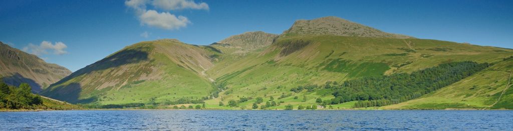
Mountain weather
Lake District Mountain weather forecast table
Confidence
High confidence for rain and stronger winds for a time on Saturday before turning more settled. High confidence for dry and settled conditions set to persist into next week.
This evening forecast
Mostly cloudy with some clearer intervals and a few showers. Fresh to strong southwesterly winds.
Mountain weather hazards
Hazards apply at or above 300m, reflecting the more severe conditions which can occur at altitude.
 Severe Chill Effect
Wind significantly lowers the ‘feels-like’ temperature relative to the actual temperature, with even moderate winds significantly adding to the chilling effect. Strong winds can result in a severe and debilitating wind chill many degrees below the actual temperature. This effect will be enhanced in rain or wet snow. Without protection, prolonged exposure could result in frost nip or frostbite on exposed parts of the body and/or hypothermia.
Poor Visibility
Poor visibility presents challenging route finding conditions. Visibility could be significantly less than 50 metres in all directions with few or no visual references, especially on featureless moors or plateaux. Distances become hard to judge and cliff or cornice edges can be difficult to recognise. These conditions require good navigational skills. There is a risk of white-out conditions when mist or fog is combined with extensive snow cover.
Strong Sunlight
Harmful UV levels from sunlight increase with altitude giving a greater risk of sunburn and eye damage, even on some overcast days. On breezy days, the cooling effect of wind on exposed skin may disguise any feeling of sunburn until it is too late. If there is snow cover, glare increases the effect of UV rays especially on the eyes. It is advisable to wear sun block, protective clothing such as a long-sleeved top and hat and have good quality eye protection.
Mountain weather forecast
Cloudy with rain at first, turning dry with sunny spells later. Winds easing through the day. Cold on higher routes.
| Time | 00:00 | 03:00 | 06:00 | 09:00 | 12:00 | 15:00 | 18:00 | 21:00 |
|---|---|---|---|---|---|---|---|---|
Weather (at 800m) |
|
|
|
|
|
|
|
|
Chance of precipitation (at 800m) |
20% | 60% | 40% | 10% | <05% | 00% | 00% | 00% |
Wind direction and speed (mph)
Altitude above mean sea level
| Time | 00:00 | 03:00 | 06:00 | 09:00 | 12:00 | 15:00 | 18:00 | 21:00 |
|---|---|---|---|---|---|---|---|---|
| 900m |
SW
34
|
SW
28
|
W
23
|
W
21
|
W
20
|
W
22
|
W
20
|
NW
18
|
| 600m |
SW
27
|
SW
23
|
W
19
|
W
18
|
W
19
|
W
20
|
W
17
|
NW
15
|
| 300m |
SW
12
|
SW
10
|
W
9
|
W
9
|
W
12
|
W
12
|
W
10
|
NW
6
|
| Valley |
SW
11
|
SW
11
|
W
10
|
W
10
|
W
12
|
W
12
|
W
10
|
NW
6
|
Wind gust (mph)
Altitude above mean sea level
| Time | 00:00 | 03:00 | 06:00 | 09:00 | 12:00 | 15:00 | 18:00 | 21:00 |
|---|---|---|---|---|---|---|---|---|
| 900m | 42 | 35 | 29 | 28 | 28 | 30 | 27 | 24 |
| 600m | 37 | 31 | 26 | 25 | 27 | 29 | 24 | 23 |
| 300m | 30 | 25 | 22 | 22 | 24 | 25 | 22 | 17 |
| Valley | 27 | 24 | 22 | 20 | 22 | 23 | 19 | 16 |
Altitude above mean sea level
| Time | 00:00 | 03:00 | 06:00 | 09:00 | 12:00 | 15:00 | 18:00 | 21:00 |
|---|---|---|---|---|---|---|---|---|
| 900m |
3°
|
2°
|
2°
|
2°
|
3°
|
3°
|
2°
|
0°
|
| 600m |
5°
|
4°
|
4°
|
4°
|
5°
|
6°
|
5°
|
3°
|
| 300m |
7°
|
6°
|
6°
|
7°
|
9°
|
9°
|
7°
|
5°
|
| Valley |
9°
|
9°
|
8°
|
9°
|
11°
|
11°
|
10°
|
7°
|
| Freezing Level |
1,200m
|
1,200m
|
1,200m
|
1,100m
|
1,100m
|
1,000m
|
1,000m
|
900m
|
Altitude above mean sea level
| Time | 00:00 | 03:00 | 06:00 | 09:00 | 12:00 | 15:00 | 18:00 | 21:00 |
|---|---|---|---|---|---|---|---|---|
| 900m |
-4°
|
-5°
|
-5°
|
-4°
|
-3°
|
-3°
|
-4°
|
-5°
|
| 600m |
-1°
|
-2°
|
-2°
|
-1°
|
0°
|
1°
|
0°
|
-2°
|
| 300m |
4°
|
3°
|
3°
|
4°
|
6°
|
6°
|
4°
|
2°
|
| Valley |
6°
|
6°
|
6°
|
7°
|
8°
|
8°
|
7°
|
6°
|
Additional weather information
Meteorologist's view
Low cloud and rain in the morning may make for tricky navigation, with strong winds making for slow progress, but these easing later. Improving conditions in the afternoon. Cold on higher routes.
Weather
A mostly cloudy morning with a few outbreaks of rain and drizzle. Turning drier from late morning with sunny spells developing. Longer sunny and clear periods from late afternoon and through the evening. Strong southwesterly winds becoming fresh northwesterlies later.
Chance of cloud-free hill tops
10% most of the morning, from late morning increasing to 95%.
Low cloud and visibility
Widespread low cloud with base around 500m for much of the morning. Cloud starting to lift and break from late morning, some 800-1000m bases lingering through early afternoon before rising above summits. Visibility poor in cloud and rain in the morning, becoming good later.
Ground conditions
No recent ground conditions report available.
Mountain weather information
Weather
Fog patches in the valleys at first but these soon clearing after dawn to leave a dry day with patchy cloud and sunny spells. Light or moderate northwesterly winds. Chilly on higher routes.
Chance of cloud-free hill tops
100%.
Maximum wind speed expected
Northwest 15-20mph.
Temperature
- At 800m Between 0 and plus 1C.
- Valley Plus 2 or 3C in the morning, rising to Plus 12C in the afternoon.
- Freezing level 800-1000m.
Low cloud and visibility
A little fog in the valleys at first but this soon clearing with any cloud above summits for the rest of the day. Visibility poor in fog, otherwise good.
Mountain weather information
Mon 20 Apr
Sunrise:
Sunset:
Sunny spells and a few showers possible. Light to moderate northerly winds. Freezing level 800-1000m.
Tue 21 Apr
Sunrise:
Sunset:
Dry with and mostly sunny. Breezy northeasterly winds may be strong on highest routes. Freezing level 800-1000m.
Wed 22 Apr
Sunrise:
Sunset:
Dry with sunny spells. Breezy. Freezing level 800-1000m.
Updated at:
Summit specific forecast
Mountain summit forecast map
Loading map…
Key
The Lake District covers an area of 885 square miles with its highest point, Scafell Pike, standing at 978 metres.