
Mountain weather
Mourne Mountains Mountain weather forecast table
Confidence
High for changeable weather for the next few days.
This evening forecast
Cold and windy with occasional snow showers. Strong northwesterly winds.
Mountain weather hazards
Hazards apply at or above 300m, reflecting the more severe conditions which can occur at altitude.
 Poor Visibility
Poor visibility presents challenging route finding conditions. Visibility could be significantly less than 50 metres in all directions with few or no visual references, especially on featureless moors or plateaux. Distances become hard to judge and cliff or cornice edges can be difficult to recognise. These conditions require good navigational skills. There is a risk of white-out conditions when mist or fog is combined with extensive snow cover.
Severe Chill Effect
Wind significantly lowers the ‘feels-like’ temperature relative to the actual temperature, with even moderate winds significantly adding to the chilling effect. Strong winds can result in a severe and debilitating wind chill many degrees below the actual temperature. This effect will be enhanced in rain or wet snow. Without protection, prolonged exposure could result in frost nip or frostbite on exposed parts of the body and/or hypothermia.
Mountain weather forecast
Cloudy with occasional rain in the afternoon and evening
| Time | 00:00 | 03:00 | 06:00 | 09:00 | 12:00 | 15:00 | 18:00 | 21:00 |
|---|---|---|---|---|---|---|---|---|
Weather (at 700m) |
|
|
|
|
|
|
|
|
Chance of precipitation (at 700m) |
00% | 00% | 00% | 20% | 40% | 40% | 40% | 40% |
Wind direction and speed (mph)
Altitude above mean sea level
| Time | 00:00 | 03:00 | 06:00 | 09:00 | 12:00 | 15:00 | 18:00 | 21:00 |
|---|---|---|---|---|---|---|---|---|
| 600m |
NW
21
|
NW
17
|
W
15
|
W
15
|
W
15
|
SW
18
|
SW
19
|
SW
22
|
| 300m |
NW
10
|
NW
8
|
W
7
|
W
8
|
SW
10
|
SW
11
|
SW
11
|
SW
11
|
| Valley |
NW
8
|
NW
6
|
W
5
|
W
7
|
SW
9
|
SW
10
|
SW
9
|
SW
8
|
Wind gust (mph)
Altitude above mean sea level
| Time | 00:00 | 03:00 | 06:00 | 09:00 | 12:00 | 15:00 | 18:00 | 21:00 |
|---|---|---|---|---|---|---|---|---|
| 600m | 29 | 24 | 21 | 21 | 21 | 25 | 26 | 30 |
| 300m | 20 | 16 | 14 | 14 | 17 | 19 | 19 | 19 |
| Valley | 18 | 15 | 12 | 14 | 16 | 18 | 18 | 17 |
Altitude above mean sea level
| Time | 00:00 | 03:00 | 06:00 | 09:00 | 12:00 | 15:00 | 18:00 | 21:00 |
|---|---|---|---|---|---|---|---|---|
| 600m |
-1°
|
-1°
|
0°
|
1°
|
3°
|
3°
|
3°
|
4°
|
| 300m |
1°
|
0°
|
1°
|
4°
|
6°
|
6°
|
5°
|
6°
|
| Valley |
2°
|
1°
|
1°
|
5°
|
7°
|
7°
|
7°
|
7°
|
| Freezing Level |
500m
|
400m
|
400m
|
600m
|
700m
|
900m
|
1,800m
|
1,800m
|
Altitude above mean sea level
| Time | 00:00 | 03:00 | 06:00 | 09:00 | 12:00 | 15:00 | 18:00 | 21:00 |
|---|---|---|---|---|---|---|---|---|
| 600m |
-8°
|
-7°
|
-6°
|
-5°
|
-2°
|
-2°
|
-2°
|
-2°
|
| 300m |
-3°
|
-3°
|
-3°
|
0°
|
2°
|
2°
|
2°
|
2°
|
| Valley |
-1°
|
-2°
|
-1°
|
2°
|
4°
|
4°
|
4°
|
4°
|
Additional weather information
Meteorologist's view
Nothing to add
Weather
Most of the morning will be dry, a little light rain possible for a time late morning. The afternoon and evening will be cloudy with occasional light rain.
Chance of cloud-free hill tops
60%, best chance in the morning
Low cloud and visibility
Good visibility with patchy cloud above 800 metres for most of the day. Hill fog will lower to 300 to 600 metres from late afternoon and become more extensive from late afternoon.
Mountain weather information
Weather
Rain clearing away in the early hours, then the rest of the morning will be dry. The afternoon and evening with see sunny or clear periods and a few passing showers. Showers will fall as hail, and increasingly as sleet and snow.. Strong and blustery summit winds with significant wind chill.
Chance of cloud-free hill tops
70%
Maximum wind speed expected
Westerly average speeds of 35 mph with gusts to 50 mph on the summits
Temperature
- At 700m Plus 6 falling to minus 1 Celsius
- Valley Plus 4 rising to 9 Celsius
- Freezing level Above summits falling to 600 metres
Low cloud and visibility
Very good visibility outside of cloud and showers. Cloud lowering to 800 metres as showers pass by.
Mountain weather information
Sat 28 Mar
Sunrise:
Sunset:
A few wintry showers at first otherwise becoming dry. Cold with strong northwesterly winds. Freezing level 600 metres.
Sun 29 Mar
Sunrise:
Sunset:
*Rain spreadinfg southeast during the morning. Then brighter and drier in the afternoon with a few showers, wintry on the summits later. Windy with southwesterly summit gales. Freezing level above summits falling to 800 metres after dark.
Mon 30 Mar
Sunrise:
Sunset:
Isolated wintry showers at first, otherwise dry. Occasional rain will spread northeast later in the day. Freezing level 800 metres rising above summits later.
Updated at:
Summit specific forecast
Mountain summit forecast map
Loading map…
Key
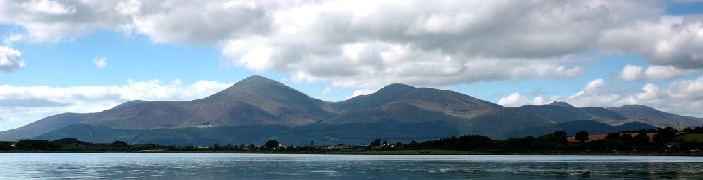
The Mourne Mountains are a granite mountain range in County Down in the southeast of Northern Ireland, is an area of outstanding natural beauty, and has been proposed as the first National Park in Northern Ireland.