
Mountain weather
Peak District Mountain weather forecast table
Confidence
High confidence that high pressure will bring a lot of dry, settled and very mild weather over the next few days. There is some uncertainty in day to day cloud amounts.
This evening forecast
Dry with clear skies. Fresh southerly winds on the tops.
Mountain weather hazards
Hazards apply at or above 300m, reflecting the more severe conditions which can occur at altitude.
 Strong Sunlight
Harmful UV levels from sunlight increase with altitude giving a greater risk of sunburn and eye damage, even on some overcast days. On breezy days, the cooling effect of wind on exposed skin may disguise any feeling of sunburn until it is too late. If there is snow cover, glare increases the effect of UV rays especially on the eyes. It is advisable to wear sun block, protective clothing such as a long-sleeved top and hat and have good quality eye protection.
Mountain weather forecast
Dry and sunny and feeling very mild or rather warm. Light winds.
| Time | 00:00 | 03:00 | 06:00 | 09:00 | 12:00 | 15:00 | 18:00 | 21:00 |
|---|---|---|---|---|---|---|---|---|
Weather (at 600m) |
|
|
|
|
|
|
|
|
Chance of precipitation (at 600m) |
00% | 00% | 00% | 00% | 00% | 00% | 00% | 00% |
Wind direction and speed (mph)
Altitude above mean sea level
| Time | 00:00 | 03:00 | 06:00 | 09:00 | 12:00 | 15:00 | 18:00 | 21:00 |
|---|---|---|---|---|---|---|---|---|
| 600m |
SW
18
|
SW
14
|
S
10
|
SE
12
|
SE
13
|
S
12
|
SE
9
|
SE
11
|
| 300m |
S
11
|
SE
7
|
SE
5
|
SE
5
|
S
10
|
S
10
|
SE
5
|
E
5
|
| Valley |
S
5
|
SE
4
|
E
4
|
E
4
|
SE
7
|
SE
7
|
SE
4
|
E
5
|
Wind gust (mph)
Altitude above mean sea level
| Time | 00:00 | 03:00 | 06:00 | 09:00 | 12:00 | 15:00 | 18:00 | 21:00 |
|---|---|---|---|---|---|---|---|---|
| 600m | 24 | 18 | 13 | 16 | 18 | 16 | 14 | 15 |
| 300m | 20 | 10 | 9 | 10 | 15 | 14 | 9 | 11 |
| Valley | 18 | 11 | 9 | 9 | 12 | 13 | 9 | 10 |
Altitude above mean sea level
| Time | 00:00 | 03:00 | 06:00 | 09:00 | 12:00 | 15:00 | 18:00 | 21:00 |
|---|---|---|---|---|---|---|---|---|
| 600m |
6°
|
7°
|
7°
|
9°
|
11°
|
12°
|
10°
|
10°
|
| 300m |
8°
|
8°
|
8°
|
10°
|
13°
|
15°
|
13°
|
11°
|
| Valley |
7°
|
7°
|
7°
|
10°
|
15°
|
16°
|
13°
|
11°
|
| Freezing Level |
1,600m
|
1,700m
|
1,900m
|
1,900m
|
2,000m
|
2,100m
|
2,100m
|
2,100m
|
Altitude above mean sea level
| Time | 00:00 | 03:00 | 06:00 | 09:00 | 12:00 | 15:00 | 18:00 | 21:00 |
|---|---|---|---|---|---|---|---|---|
| 600m |
2°
|
3°
|
4°
|
6°
|
8°
|
10°
|
9°
|
7°
|
| 300m |
6°
|
6°
|
6°
|
9°
|
11°
|
13°
|
12°
|
10°
|
| Valley |
6°
|
6°
|
5°
|
10°
|
14°
|
15°
|
13°
|
10°
|
Additional weather information
Meteorologist's view
Good hillwalking conditions but feeling rather warm in the valleys in the afternoon with highs of 16 to 18 Celsius.
Weather
A chilly night with clear skies. A few fog patches at first but these quickly clearing, otherwise a dry day with plenty of sunshine and feeling rather warm in the valleys. Dry evening with long clear spells.
Chance of cloud-free hill tops
100%.
Low cloud and visibility
Mainly good visibility. Patchy fog in the valleys at first but this soon clearing.
Recent rainfall
Location: Cat & Fiddle (Midway between Buxton and Macclesfield)
Altitude: 511m
| Last 24 hours | Last 48 hours | Last 72 hours |
|---|---|---|
| 1.7mm | 13mm | 20mm |
Measurement date:
Rainfall data provided by the Environment Agency. The Met Office is not responsible for content provided by third parties and may remove this data without warning.
Mountain weather information
Weather
Dry with clear spells overnight. Thursday will remain dry with plenty of sunshine but feeling a little cooler on the tops in the easterly breeze.
Chance of cloud-free hill tops
95%.
Maximum wind speed expected
East or Southeast 10 to 15mph.
Temperature
- At 600m Plus 7C rising to 11C during daytime.
- Valley Plus 7C rising to 15 or 16C.
- Freezing level Above summits.
Low cloud and visibility
Good visibility with little cloud expected.
Mountain weather information
Fri 20 Mar
Sunrise:
Sunset:
High pressure will continue to bring dry weather with plenty of sunshine and light winds. Mild by day and rather chilly overnight. Freezing level above summits.
Sat 21 Mar
Sunrise:
Sunset:
Remaining dry with bright or sunny spells and light winds. Mild by day and rather chilly overnight. Freezing level above summits.
Sun 22 Mar
Sunrise:
Sunset:
Likely to stay dry and bright but a small chance of cloud and rain spreading in from the west later with strengthening winds. Freezing level above summits.
Updated at:
Summit specific forecast
Mountain summit forecast map
Loading map…
Key
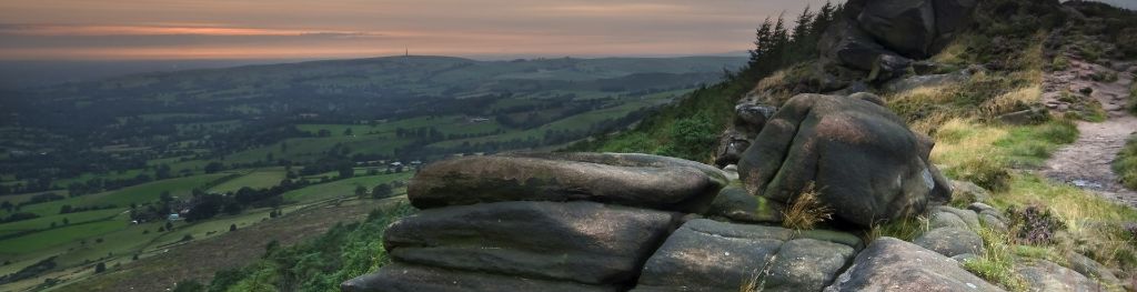
The Peak District is home to a wide variety of magnificent hills, moors, outcrops and gritstone edges.