
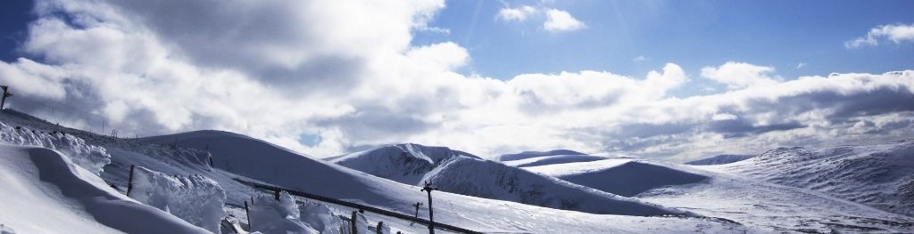
Mountain weather
South Grampian and Southeast Highlands Mountain weather forecast table
Confidence
High confidence in the unsettled conditions for the next few days, followed by a change to drier conditions and lighter winds by Sunday.
Mountain weather hazards
Hazards apply at or above 300m, reflecting the more severe conditions which can occur at altitude.
 Gales
Gales
Gale force winds (gusts over 50mph) make walking difficult and strenuous with a potential to be blown over by gusts. There is often a marked increase in winds through cols or on exposed ridges and summits. Distances can take longer to cover and compass bearings become harder to follow accurately.
Severe Chill Effect
Wind significantly lowers the ‘feels-like’ temperature relative to the actual temperature, with even moderate winds significantly adding to the chilling effect. Strong winds can result in a severe and debilitating wind chill many degrees below the actual temperature. This effect will be enhanced in rain or wet snow. Without protection, prolonged exposure could result in frost nip or frostbite on exposed parts of the body and/or hypothermia.
Poor Visibility
Poor visibility presents challenging route finding conditions. Visibility could be significantly less than 50 metres in all directions with few or no visual references, especially on featureless moors or plateaux. Distances become hard to judge and cliff or cornice edges can be difficult to recognise. These conditions require good navigational skills. There is a risk of white-out conditions when mist or fog is combined with extensive snow cover.
Strong Sunlight
Harmful UV levels from sunlight increase with altitude giving a greater risk of sunburn and eye damage, even on some overcast days. On breezy days, the cooling effect of wind on exposed skin may disguise any feeling of sunburn until it is too late. If there is snow cover, glare increases the effect of UV rays especially on the eyes. It is advisable to wear sun block, protective clothing such as a long-sleeved top and hat and have good quality eye protection.

Mountain weather forecast
Rather cloudy with scattered showers. Drier, brighter in the afternoon. Gales on tops with a significant windchill.
| Time | 06:00 | 09:00 | 12:00 | 15:00 | 18:00 | 21:00 |
|---|---|---|---|---|---|---|
Weather (at 800m) |
|
|
|
|
|
|
Chance of precipitation (at 800m) |
30% | 40% | 40% | 30% | 20% | 20% |
Wind direction and speed (mph)
Altitude above mean sea level
| Time | 06:00 | 09:00 | 12:00 | 15:00 | 18:00 | 21:00 |
|---|---|---|---|---|---|---|
| 1100m |
SW
37
|
SW
41
|
SW
35
|
SW
29
|
SW
26
|
S
33
|
| 900m |
SW
25
|
SW
30
|
SW
27
|
SW
23
|
SW
18
|
S
21
|
| 600m |
SW
14
|
SW
22
|
SW
20
|
SW
15
|
SW
11
|
S
12
|
| 300m |
SW
6
|
SW
13
|
SW
14
|
SW
12
|
S
5
|
S
5
|
| Glen |
SW
7
|
SW
12
|
SW
15
|
SW
12
|
SW
6
|
SW
5
|
Wind gust (mph)
Altitude above mean sea level
| Time | 06:00 | 09:00 | 12:00 | 15:00 | 18:00 | 21:00 |
|---|---|---|---|---|---|---|
| 1100m | 43 | 50 | 43 | 36 | 32 | 42 |
| 900m | 31 | 38 | 36 | 30 | 24 | 31 |
| 600m | 27 | 38 | 34 | 27 | 21 | 27 |
| 300m | 17 | 28 | 27 | 24 | 13 | 14 |
| Glen | 18 | 23 | 28 | 24 | 14 | 15 |
Altitude above mean sea level
| Time | 06:00 | 09:00 | 12:00 | 15:00 | 18:00 | 21:00 |
|---|---|---|---|---|---|---|
| 1100m |
0°
|
0°
|
2°
|
2°
|
2°
|
2°
|
| 900m |
2°
|
2°
|
4°
|
5°
|
4°
|
4°
|
| 600m |
4°
|
5°
|
7°
|
8°
|
7°
|
6°
|
| 300m |
7°
|
8°
|
10°
|
11°
|
10°
|
8°
|
| Glen |
8°
|
10°
|
12°
|
12°
|
11°
|
9°
|
| Freezing Level |
1,100m
|
1,200m
|
1,300m
|
1,300m
|
1,300m
|
1,400m
|
Altitude above mean sea level
| Time | 06:00 | 09:00 | 12:00 | 15:00 | 18:00 | 21:00 |
|---|---|---|---|---|---|---|
| 1100m |
-9°
|
-9°
|
-6°
|
-5°
|
-5°
|
-6°
|
| 900m |
-5°
|
-5°
|
-2°
|
-1°
|
-1°
|
-2°
|
| 600m |
0°
|
0°
|
3°
|
4°
|
4°
|
2°
|
| 300m |
5°
|
5°
|
8°
|
8°
|
8°
|
7°
|
| Glen |
6°
|
7°
|
9°
|
10°
|
9°
|
8°
|
Additional weather information
Met Office Aberdeen meteorologist's view
A challenging day with gusts to around 50mph on summits and ridges which will give very difficult walking conditions with a significant risk of being blown over. Note the sub zero wind chill on the upper slopes.
Weather
Rather cloudy with patchy hill fog and scattered showers, some heavy and wintry above 1000m. The best of the drier, sunnier spells will develop during the afternoon. Strong to gale force winds on tops bringing a significant windchill.
Chance of cloud-free hill tops
40% in the morning, increasing to 70% in the afternoon.
Low cloud and visibility
A few patches of low cloud with bases around 800m at first, these lifting above most tops in the afternoon but dropping again and becoming extensive overnight. Visibility will be generally good below cloud bases but perhaps briefly deteriorating to a few kilometres in showers.
Mountain weather information
Weather
Very windy with gales or severe gales on tops. A cloudy morning with patchy rain followed by a brighter afternoon with showers, some heavy with hail and the odd rumble of thunder.
Chance of cloud-free hill tops
20% increasing to 50%.
Maximum wind speed expected
Mean 35-45mph gusting 55-65mph on summits and ridges.
Temperature
- At 800m Plus 5 rising 7 celsius.
- Glen Plus 9 rising 14 celsius.
- Freezing level Above summits.
Low cloud and visibility
Fairly extensive cloud bases down to around 700m in the morning, lifting to 1000m with occasional breaks in the afternoon. Visibility will be generally good below cloud bases, but occasionally deteriorating to a few kilometres in rain or showers.
Mountain weather information
Sat 18 Apr
Sunrise:
Sunset:
Another very windy day with gales or severe gales on summits and a bitter wind chill. Bright spells and scattered showers, wintry above 800m.
Sun 19 Apr
Sunrise:
Sunset:
Rather cloudy with scattered light showers, wintry above 1000m. Moderate to fresh summit winds.
Mon 20 Apr
Sunrise:
Sunset:
Variable cloud but mostly dry and settled with gentle winds.
Updated at:
Summit specific forecast
Mountain summit forecast map
Loading map…
Key
Including South and East Cairngorms National Park, Aberdeenshire and Angus Hills, Ben Vrackie, Ben Lawers, Loch Tay and Ochils
For snow and avalanche hazard forecasts please visit Scottish Avalanche Information Service